Green Mountain
(North Cascade View Central Command)
(this page is best viewed at 1024x768 at least!)
(Click on most of these pics for bigger versions)
![]()
July 30, 2000
I'd call this "Buggy Peak", but there will probably be too many Buggy Peaks this year to do that. Every trip report I see mentions how horrible the bugs are. Great. Oh well. As long as you keep moving.
The majority of the text written here was adapted from a trail report I filed with the WTA. Go check it out! Select Green Mountain #782. Mine starts with "Oh my god." :)
I was one of a dozen WTA volunteers a few weeks ago working on retread on the lower elevations of this trail. It was my first work party, and Bill and Kim made it enjoyable. The weather was foggy for most of it, but once it cleared up, I knew I had to go back and do the actual hike. It had been on my list, so today was the right time.
Ok, so this is one of the best hikes I have ever done.
 |
|
||
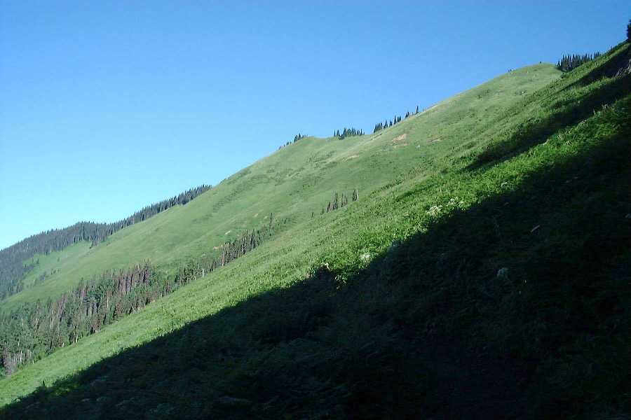
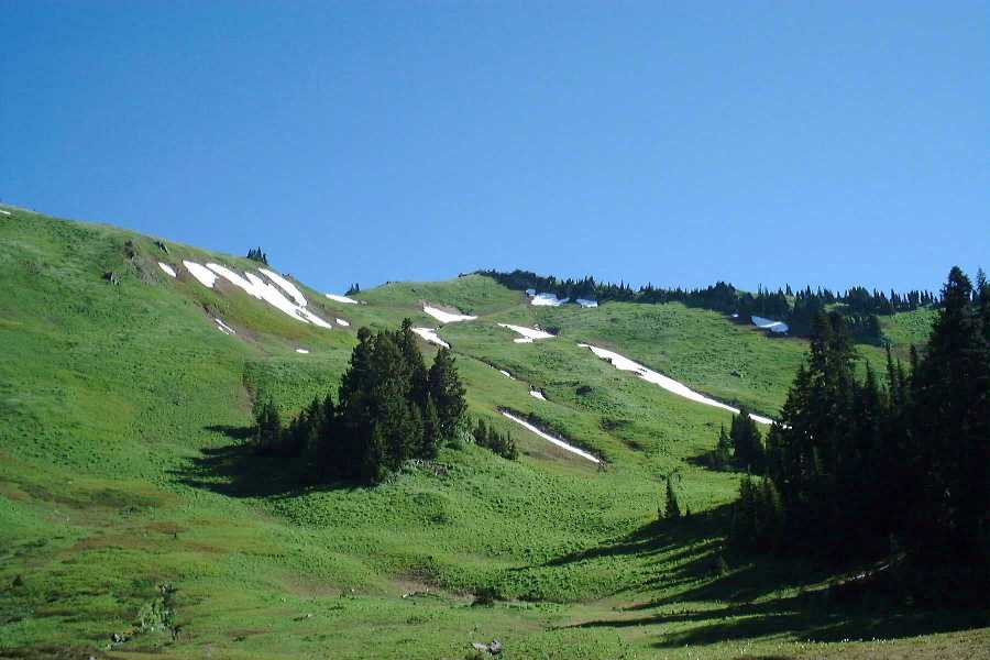
| Once
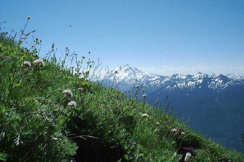
you get to the meadows, you start your spectacular views
of Glacier Peak. They never stop. Each switchback brings
even better views. The one to the right happens to be
Sunny's favorite. It's cool!
|
 |
||
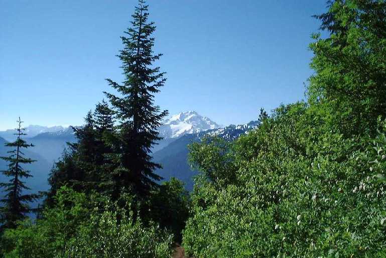 |
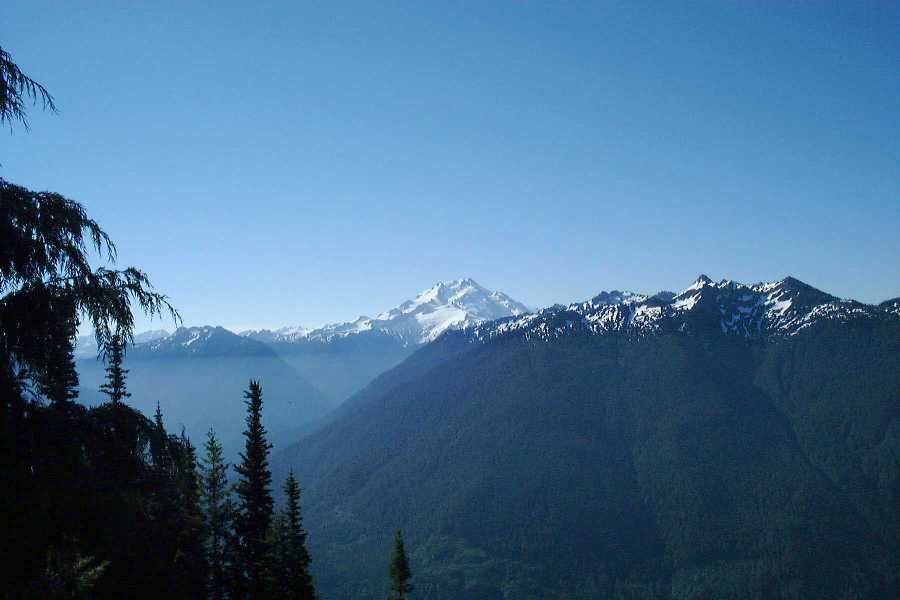
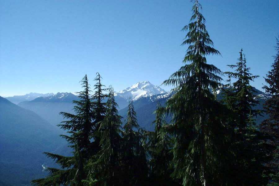
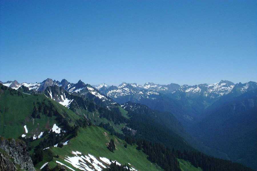
These pictures of Glacier
were all taken from where the trail turns to go to the
basin.
|
||
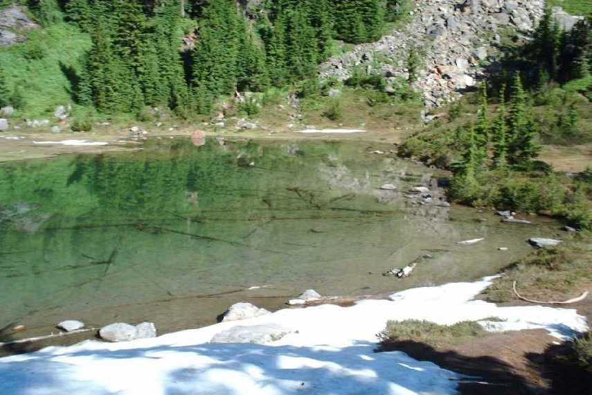
In
the basin is a beautiful tarn. This picture really does
not do it justice. Actually, none of these pictures do
anything justice. Everything is much bigger and brighter
in person. That's why I kill myself on these hikes
sometimes, just to get the personal views and memories.
This is a Tarn, Sheila. ;)
|
 |
||
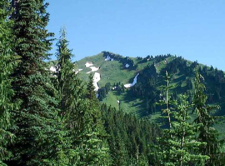 |
In
the basin, you finally get to see your destination. Damn.
It looks very far away, and because of the bugs, you
begin to question whether or not you can make it. But,
the meadows below are very inviting, so you tighten your
pack, take a deep breath, and continue, onwards and ever
upwards. Believe it or not, there is a lookout tower, right on the highest point. |
||
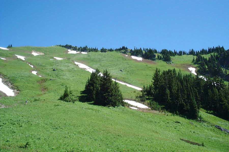
| Mmmm....
Meadowy goodness....
|
 |
||
| Once you clear these meadows and their bugs, you start a long ascent right up the damn ridge. Very steep, very difficult. But, we are seasoned and somewhat stupid, so we pressed on and finally made it to the top. | What
we bought with our sweat was one of the best views I have
ever had. I think the pictures below speak for themselves. |
||
|
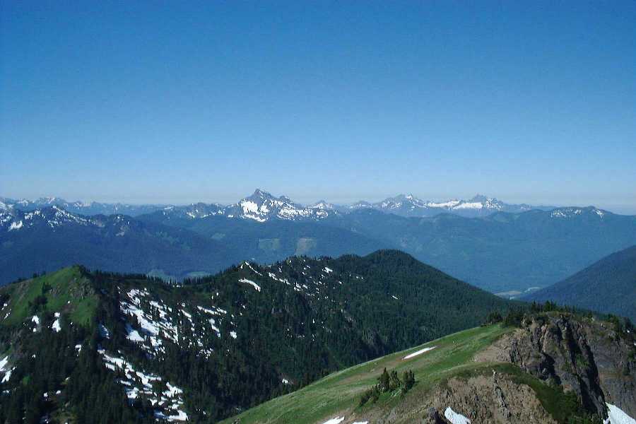
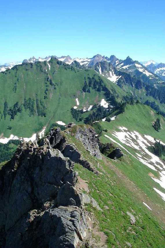
This is the view from the
top, looking down on the slope we just came up. Steep
sucka, isn't it?
|
||
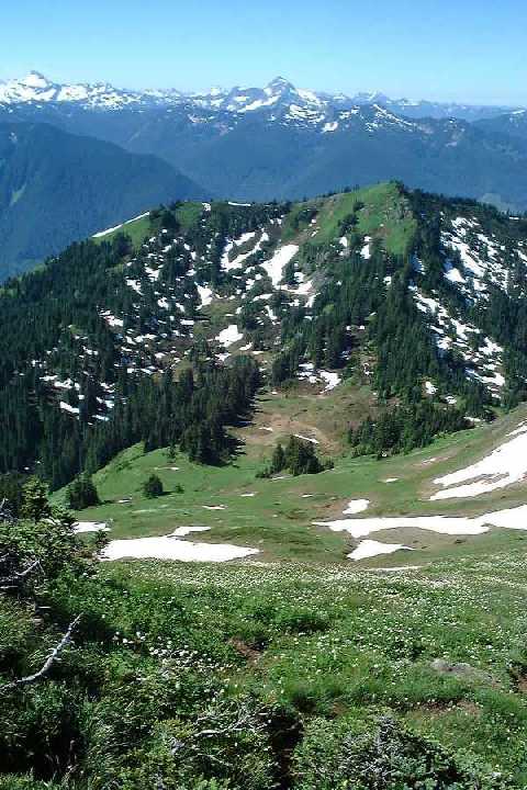
| This
is the ridge we came up. Actually, the trail is just to
the left side of the rocks. Very steep, very very very
steep.
|
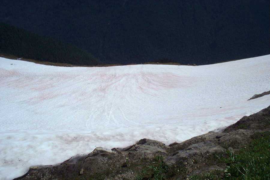 This is a snow field just below the summit on the other side. Can you say, plummet to your death? If you fall, you would slide all the way down this snowy slipperly slope, and fall off the edge. Is there something there to break your fall? Yes. But not for another 1000 feet or so. |
||
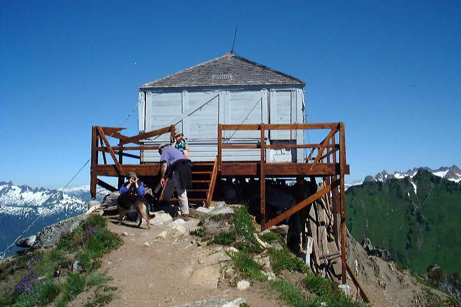
| This
is my second Lookout Tower. There are supposed to be
hundreds of these things. If I start to get a bunch of
them, maybe I'll make a seperate page. Anyway, this old tower is being rebuilt with money provided by the government. I guess Hillary Clinton got a shitload of money for restoring old lookouts throughout the country. Hummph. How about that. She actually did something worthwhile. Using these lookouts will help with forest fires, and not to mention increase visitors, and hopefully, awareness of the conditions of our forests. |
 |
||
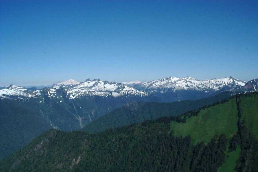
The pointy cone below is Mt. Baker. I will be up there in a few weeks.
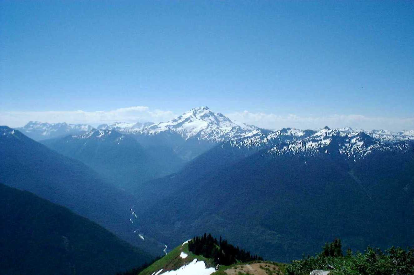
And of course, Glacier Peak. I love volcanoes....
Trail conditions were quite good overall. Not very muddy, not very rooty or rocky. And the retread areas are excellent, if I may say so. :) There are some places that need to be brushed, badly. But it is only soft vegetation, so no biggie.
Complaints? BUGS. Once you get out in the open, there are bugs everywhere. Big ones, little ones, fast ones, slow ones. And they all bite. So, despite your gasps for breath on the steep upper slopes, you have to keep going to avoid becoming insect fodder.
I highly recommend this hike to anyone who is still waiting to be impressed by the North Cascades. By the time you get past all the meadows and get to the peaks, you will be so impressed, you'll run out and join the WTA and work on their crews! :)
![]()
Ah... another good hike that was snowfree! We went on this with Kim, who I have done all my WTA trail work with. She worked on this trail last year, but had never hiked it. So, she volunteered to be our victim for the day, and we went.

The new tread looks EXCELLENT!
This is a very popular trail. But evidently, not when it is cloudy and rainy. We saw 2 other people. Good. It was a good hike, and while there were no views, it was OK because we could stop and take breaks this time around. It was cool, and there were no bugs. The snow level was at 6500ft. Can you guess where the lookout is??? Yep. 6500ft. We got snowed on in mid-July.

The upper (lower?) meadow by the tarn is a magical land. I must go camping there. There were also frog eggs in the tarn!!!


 |
Since there were no views, we took this picture of Glacier Peak that Kim took on her recent climb and held it up to the sky at about where it should be. Nothing like a beautiful mountain view!!! |
Although, as we decended the fog lifted enough to make it more visable. And we played with marmots!


Go back to the main hiking page!