(I obviously don't know....)
(this page is best viewed at 1024x768 at least!)
![]()
| March
7th, 1999 Trail 1064, in the Alpine Wilderness Area. New for me! Yay! Jen had never been to that area before either, so who knew what we were getting into. Anyway, we’re driving along Highway 2, and suddenly, these huge snowy rocky vertical mountains show up. They were spectacular! I swear, the only words spoken for miles were: "Look!" "Oh my god!" "Holy Shit!" "Jesus Christ!" "Wow!" "Why haven’t I been out here?" "What mountain is that!?" And "OhmygodOhmygodOhmygod!" |
 |
|
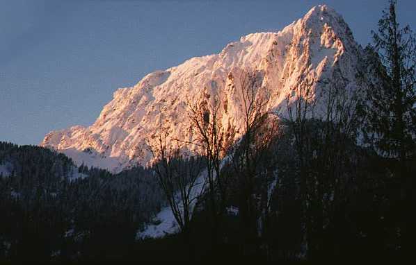
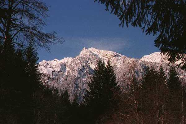
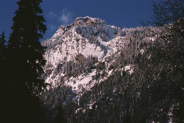
| This is Mount Index. There is a trail for Lake Serene here. Heh Heh Heh.... | ||
 |
Folks, these mountains are impressive. The cornice on one of them had it’s own zip code, and the big sucker, Mt. Index (above) looked like the 3,000 feet of vertical rock sprung up out of the ground overnight! There is a part on the road where you go around a corner surrounded by trees. Once you clear the corner, this huge domineering chuck of snow covered rock fills the sky and makes you drive off the road and die in a fiery explosion. No, but it is VERY distracting. | |
| This is Mt. Persis. This picture does not do it justice. Nor does the Index Picture, either. Maybe you should go see them yourself! :) | ||
| Anyway, we finally got to the road where the trail was. But, the 6-mile long road was only paved for 1 mile. So, being that we are determined to hike regardless of weather conditions anyway, it made perfect sense at the time to go ahead and hike the road to the trailhead. Never mind that the trail itself was 7 miles long. Distance does not seem that long when you have not done any yet. Oops. Wearing the snowshoes made it more difficult, but eh, what do we care! Stupid energy! | 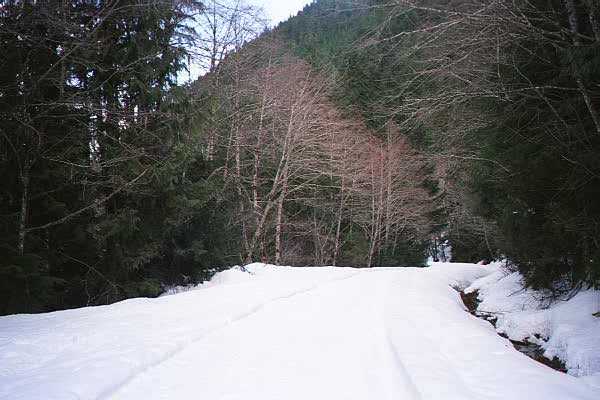 |
|
| We hiked this trail, er service road, for 5 miles. In snowshoes. Probably should have not worn the shoes. Crampons would have been fine. I think we expended too much energy with the shoes on. But, eh. I needed the practice. | ||
 |
The service road ran parallell to Maloney Ridge for the majority of the way. I need to see if there are trails on that ridge. I bet you could get some killer shots of the mountains around there. | |
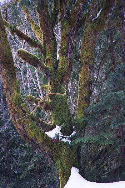
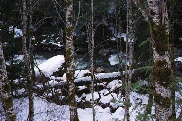
| These are a couple pictures of cool stuff along the trail. River, Trees with moss. Kewl..... | ||
 |
|
|
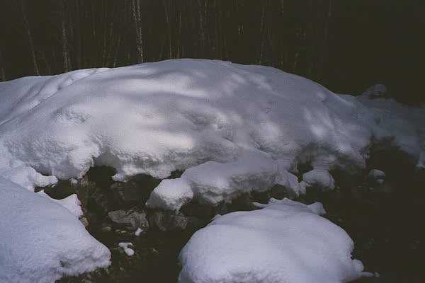 |
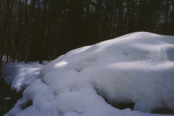
There were a couple spots on the road that were washed out. Here is one of them, covered in snow, with a running stream. | |
| We
finally got to the trailhead, and took a break. But,
where was the actual trail? I think it was hiding beneath
5 feet of snow. So, we wandered aimlessly through the
drifts and piles of snow near the river until we could go
no further without crossing the river. If we actually knew where the trail was, we would have been able to find to alledged bridge that crossed the river. |
 |
|
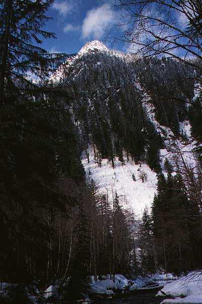
| We stopped and took a buncha pictures of the mountains nearby. | I fell through snow right here. There was nothing under it. Yay! It is quite interesting to be up to your chest in snow, hanging onto a tree, while one leg is dangling below you, not touching the ground. Yay! Woo Hoo! Yay stupidity! | |
 |
|
|
 |
 |
|
Anyway, even though we gained zilch in elevation gain, the hike was good. It was fun, since my sanity had successfully snapped the day before, but very tiring. This ended up being my last hike before my knee surgery, and it was a memorable one. These places should melt in the summer, and I can't wait to get back to check them out. But dammit, there are too many other places to check out too!!! Argh! The hell I have to endure! :)
Go back to the main hiking page!