(this page is best viewed at 1024x768 at least!)
![]()
I went back on 5/21/2000. Updates at the bottom! No link, you have to scroll! Look at my pictures! Purdy Purdy piktures!
| September
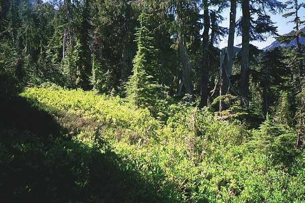
11, 1999 Went to Squire Creek Pass. It was a beautiful day. Yes, we do have those here in the Northwest. This was the place we tried to go to back in February, but some bastard tree fell down 2 miles into the 6 mile road to the trailhead, so we had to turn around. But it was clear this time. Got to the trailhead at about 8am, and no one was there. Yay! Just like it should be. Right at the start of the trail, there was a small boulder field. A sign of things to come? The trail was very rocky, quite wet in places too. I also figured out why I am always the one who goes first. I run defense against bad spots (Ankle Funland!) and all the spider webs! Yes, I get to break all of them first, so that they are clear for whoever is behind me. I'm such a nice guy. |
 |
|
 |
 |
|
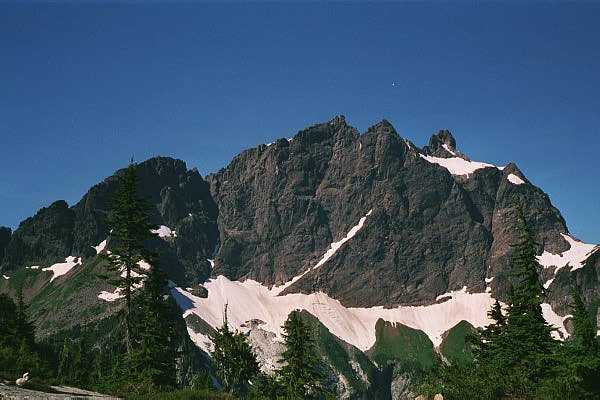
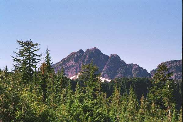
| Three Friggin Fingers! Whoah! | Three Friggin Fingers again!! Whoah! This is cool! I gotta see the other side now. | |
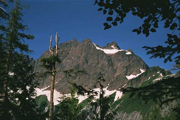
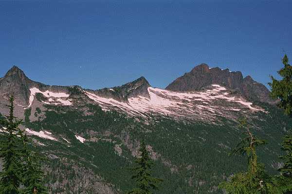
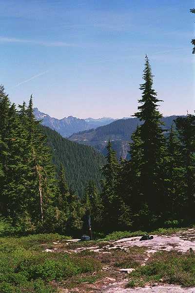
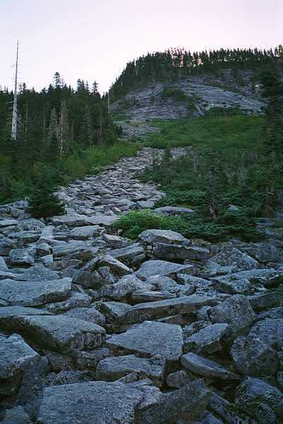
| Anyway, before long you start to be able to see Three Fingers, Whitehorse, and Big Bear, but only through the trees. But you can't really focus on them, because the trail demands your attention at all times. It is very rocky, and there is an abundance of exposed roots waiting to reach up and grab your ankle. It is a very diverse trail. Especially when you get to the boulder fields. | 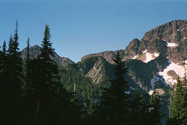 |
|
| Ahhh.... The views! | ||
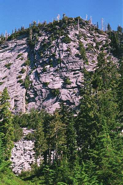
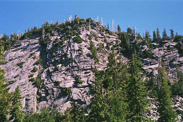
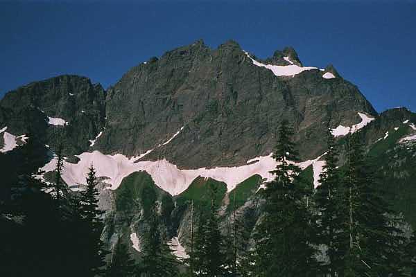
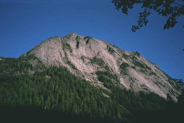 Squire Creek Wall. Un-hikable. Can you see a trail? Dammit. (Thanks to Matt Perkins for the correction.) |
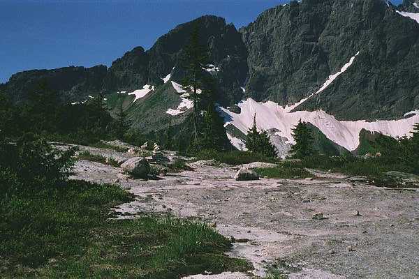
  This is where you get your first good views. Not only of the mountains I just mentioned, but of the flat slabs of granite and sandstone that flake off of the slope above you and tumble down. Very interesting. Very cool. It was still early when we got to this point so the sun had not made it there yet. It was a bit nipply. You trudge on through some very questionable spots (why the hell are we doing this?) to get up to the pass. |
|
 |
  |
|
 These slabs break off and fall down. We were walking on them! Fun! |
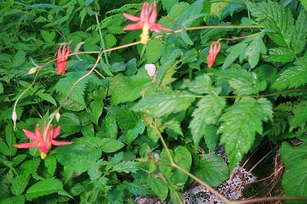
 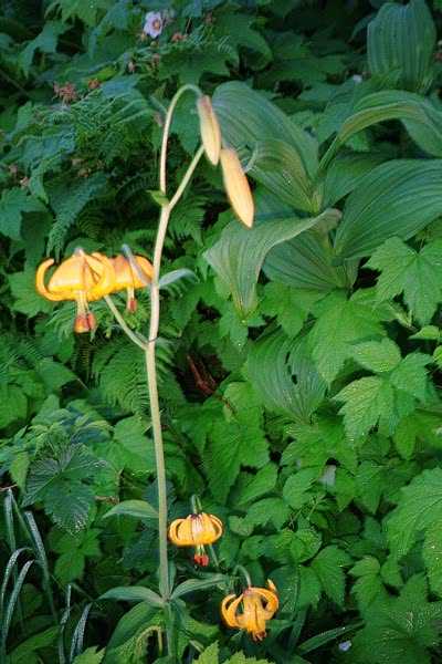 Further up the slope, nice rocks! And, purdy flowers! |
|
  |
 |
|
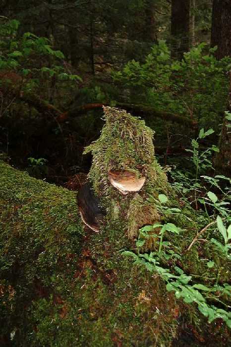
| What does the thing to the left look like? Hmmm? Looks like a gorilla muppet. Snort! | Columbine flowers! | |
|
 |
|
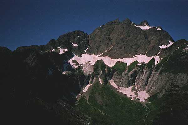
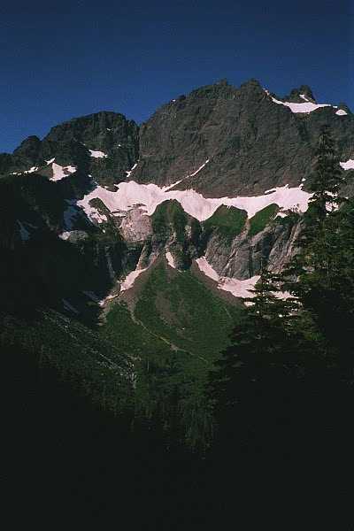
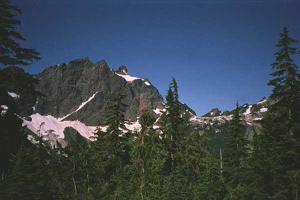
| The views! 360 degree view of all sorts of goodies. You even get to see Glacier Peak! I believe the peak of the mountain we were on is un-named. I am voting for "The Peak That Cannot Be Named". If you can brave the bugs, (BRING DEET) it is a great spot to snarf some food, or goo. Great hike. Very Alpiney. | 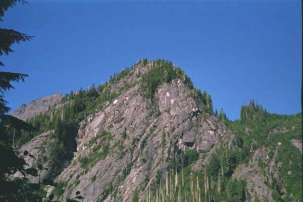 |
|
 The Pass! Nice spot! |
 |
|
| If it was not for the bugs, I could have stayed up here for hours! | ||
 |
|
|
 |
 |
|
| A rock vein. Bizarre. A different type of rock running through the granite. | ||
 Full of Alpiney goodness! |
 |
|
 |
 |
|
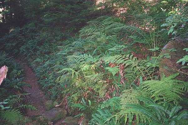
| Did I mention that I liked ferns?? I LOVE ferns. I own a fern, a gift fern! Sweet! | ||
 |
 |
|
Going down was a bit of a bitch. There are spots that made me question our sanity (for a change) on why we went on. But then I remembered that view and it all became quite clear. We met maybe 3 other groups on the way down. Great hike.
May 21, 2000 (Click on the pictures for a bigger view)
Last year this time, I was preparing for my excursion to Costa Rica, and the only hikes I did in May was Rattlesnake because everything else was under a mile of snow from our record winter. Due to many many many things good & bad happening from May to September, except for my hike in CR, I did no hikes that summer until September 11, which ironically enough (or not), happened to be SCP. It did not kill me, and I fell in love with that area of the Cascades.
This year's winter has been normal, but still many of the places I medically need to go to are snow covered and/or inaccessible. Squire Creek is supposed to melt out in late May, but as we found out in the Boulder Fields, it was not late enough in May, and we did not make it to the pass.
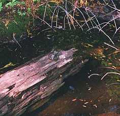
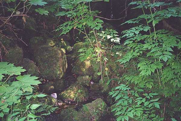
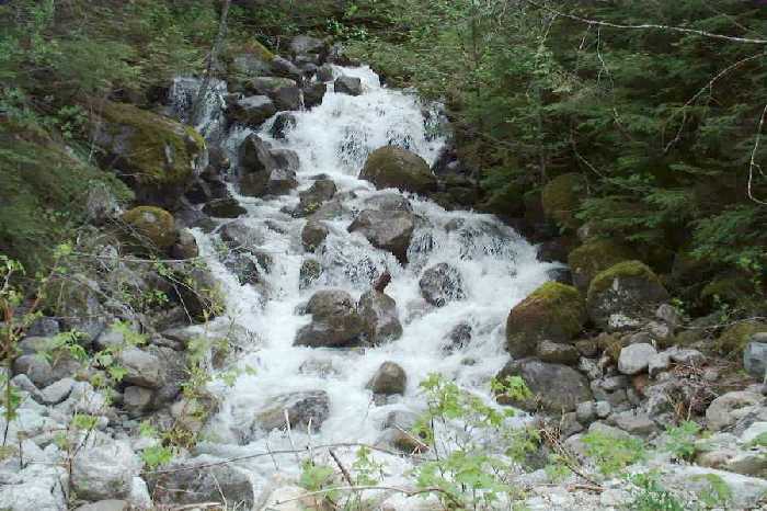
| Speaking of inaccessible, this is the creek that crosses the trailhead. Funny, In September last year, it was only a minor trickle. This time we had to climb through the wet trees and butt-walk-scootch over a wet log that was down over the creek-falls. | 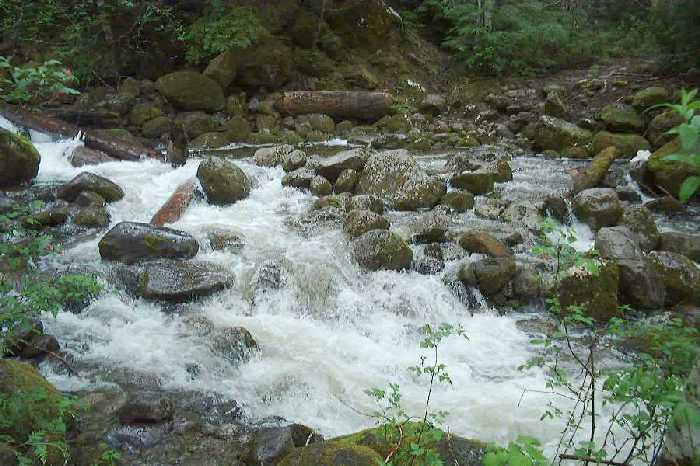 |
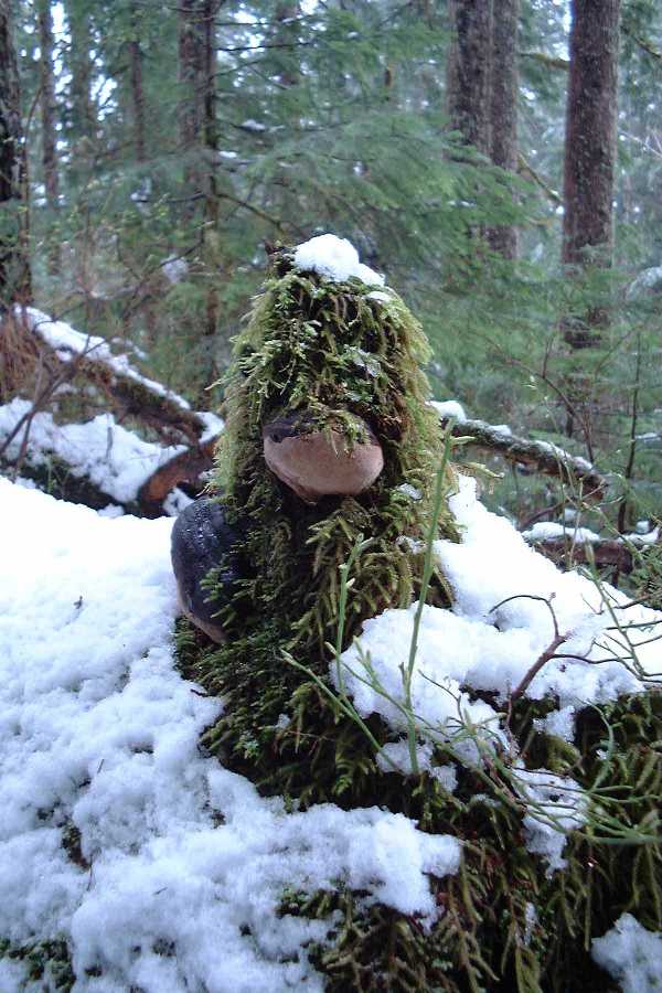
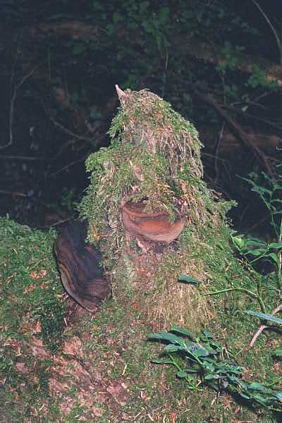
Other than coming here to see Three Fingers, Big Bear, & Whitehorse, there was one other thing I HAD to see. My Gorilla Muppet!!! Woo hoo! He's gotten fuzzier!
|
 |
||||
| This is from a much nicer camera, too. Yay Digital! | |||||
| One thing that was not there last year was the abundance of waterfalls cascading down the cliffs of the mountains on the other side of the Squire Creek valley. There were too many to even take pictures of, let alone post here, without pissing off Drizzle or ruining my already crippled checkbook. | 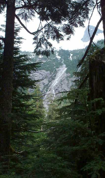 |
Anyway, I was doing fine on the hike, but Sunny was kinda tired, so we (I) slowed down. Which is not a bad idea on this trail. I thought that it was fun when dry, it is even more fun when it is muddy and icky! Wet Ankle Funland is even better! Or something.
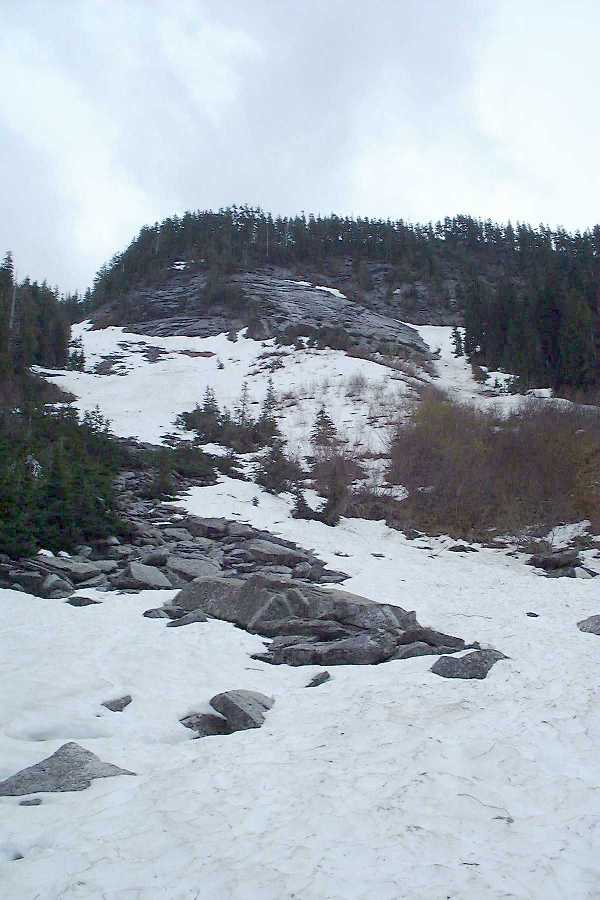
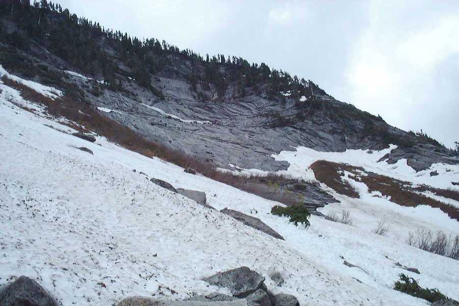
After the first set of switchbacks you enter the boulder fields, and encounter patchy snow and yet more creeks washing out the trail.
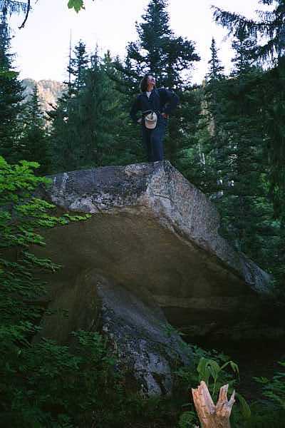
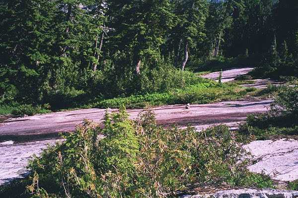
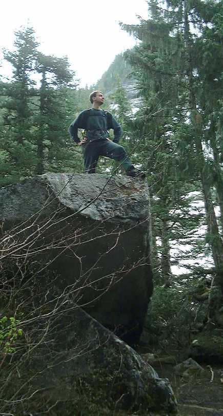
Right before the boulder fields is a favorite stopping ground of all hikers, the elevated Rock Slab! So, I had to strike a pose. Actually, 3, but you are lucky to get one, so shaddup!
Once you are in the Boulder fields, you only have one set of switchbacks to deal with, and one nasty little scramble, then you are at the pass. But there was still plenty of snow, and no one before us had ventured to the pass, so we stopped and had lunch right on an icy boulder.
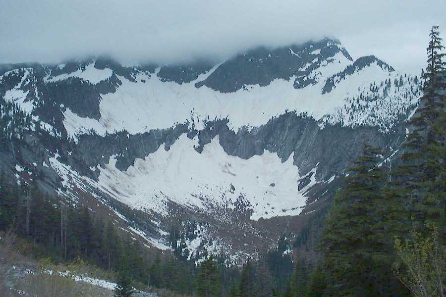
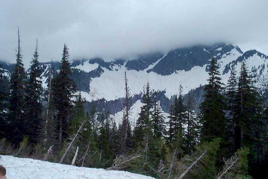
It was not a loss that we had to stop here. I got to look at one of my favorite mountains, covered in melting snow that produced dozens of waterfalls. What more could you ask for as lunch-time scenery????
Oh, and in case you wondered, we did not climb out over the tree at the first creek at the trailhead. We waded. It was cold. My boots are still wet. But I survived!!!
This was the second of 2 attempts to hike this. The first one ended up with my car getting stuck and me getting pissed of, so we went on a North Cascades road trip instead. We had a hell of a time in the snow at the end, plus it was still snowing, and there were no views. We didn't even make it as far we did last time, by about 70 yards.
I think my previous pictures pretty well document it, so I'll just give a yearly Gorilla Muppet update!
|
Still nothing new open, so it's back to Squire to try to actually complete it with Sunny. We always get stopped before the Pass, so since most guidebooks state that this one is typically open in June, we thought it would be a good bet, especially since we had such a light winter.

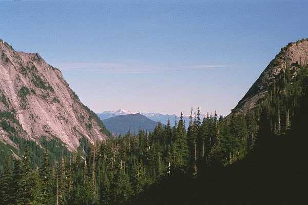
Not. It was snowy. Snowing, foggy, windy, and cold. And I was hiking with a grumpy butt. It was not a pleasing hike. The trail conditions just get worse and worse every year. Last time in April, it was snowy most of the way up to the boulder field and especially at the Gorilla Muppet. This time the snow didn't hit until after the boulder fields. We followed the path made by others, which actually never went to the pass. Where we ended up, I don't know. In the pic below, the pass is actually back towards the peak which I dubbed "The Peak Who Cannot Be Named" 2 years ago.

So, Sunny has said she's never coming back. We'll see. There is a Gorilla Muppet. Everyone loves a gorilla muppet, after all...
Go back to the main hiking page!