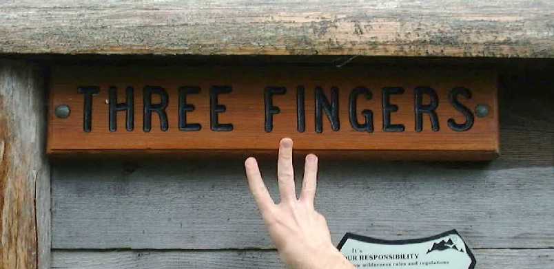
Three Fingers/Goat Flats
(Goat Floats!)
(I'm not kidding. No goats, but definitely float.)
This page best viewed at 1024x768
Click on pictures for a better view.
September 10, 2000
After my last hike at Goat Mountain, I decided to take a few weeks off to allow for a strange left hip/knee pain to go away, doctor's recommendation. It had been 3 weeks, and we were aching to go. The weekend was supposed to be clear, and we decided to go do the trail up to Three Fingers. It would be the longest hike we've done, but I knew that on a clear day, the in-your-friggin'-face view of the Mountain & the Queest-Alb glacier would make it all worthwhile.
Nature had other ideas.
First off, Three Fingers immediately became one of my top 5 mountains almost exactly one year previous on September 11 when I first went to Squire Creek Pass. I knew I had to hike it. I had seen pictures from the top & from Goat Flats, and HAD to go! So, we made it a late entry to our Gotta Go! page, and off we went.
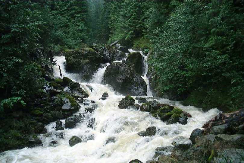 |
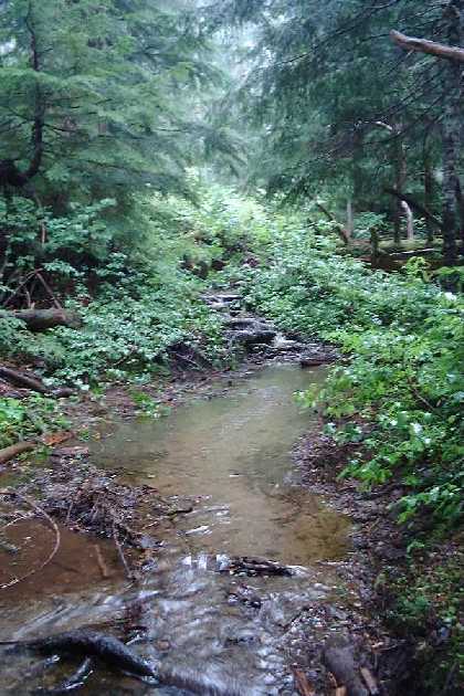
The weather turned rainy and foggy. Not just morning PNW fog or Seattle Drizzle, but all-day fog and all-day drizzle. The week previous, I was going to hike this trail alone, but I got a late start so I just drove the 18mile road the trailhead. This time I knew that we had a lot of water to deal with because there were waterfalls alongside the road that were not there before, or were nowhere near as large. |
This is the trail??????? Yep. |
The
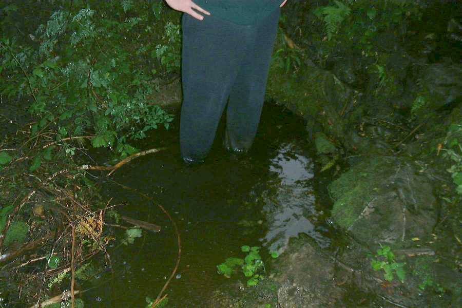
trailhead was soaked. No, not soaked. The trail was a
stream! Raging water running down the footpath. Did
someone order a drainage problem? Well, It arrived. This is why it is called Goat Floats. When Sheila & I first saw the name of the place, that is what we read. Not Flats; Floats. Oddly, It came true!
My feet were starting to get wet (duh!) almost immediately. And it was still raining. And the plants were wet. Then we got soaked. |
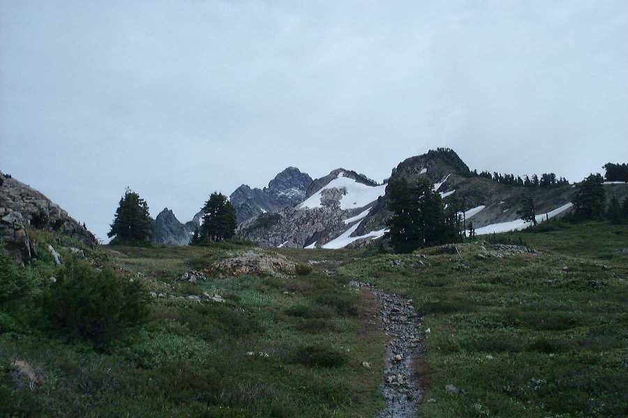
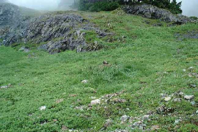
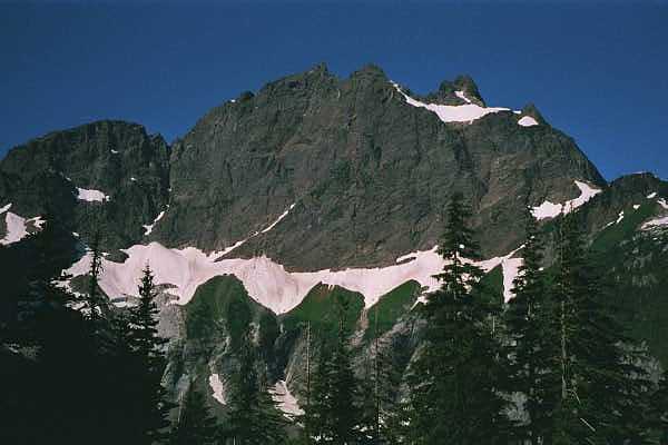
The map didn't show a change to the trail, so I got frustrated because not only was I soaked & already a bit tired not 2 miles in yet, but the map didn't tell me where I was! And the fog prevented us from seeing the surroundings. But at least there were salmon berries & blueberries. Since it had been awhile since the last hike, I started to get tired once the trail got to Goat Flats, about 4 miles & a decent chunk of elevation gain later. Goat Flats is a magical place of alpine views and meadows, but this time it was too foggy to really see it in all its glory. This is one of my favorite pictures from this hike. (I didn't get that many, but still....) The pointy thing right in the center & in the background is one Finger of Three Fingers.
Sunny was tired too, but she wanted to press on, so I grumbled and went on. I'm glad I did. Immediately upon leaving Goat Floats, we entered another magical land. We named this Marmot Scree. Between the way up & down, we probably saw 20+ MARMOTS!!!! Have I mentioned I like marmots? It was so foggy that they were whistling to each other to alert them of our presence. There were baby marmots too!
Marmots!! Marmots!! Marmots!! Marmots!! Marmots!! Marmots!! Marmots!! Marmots!!
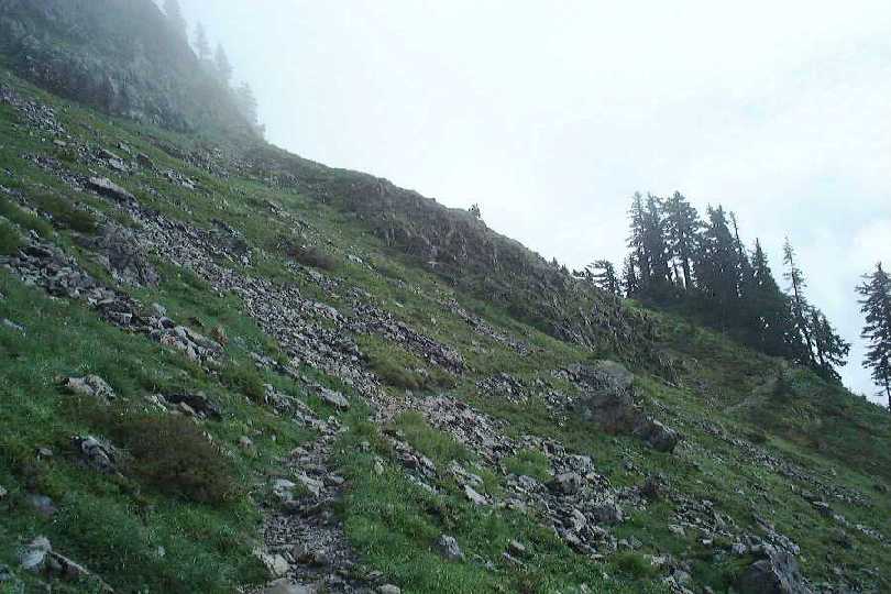
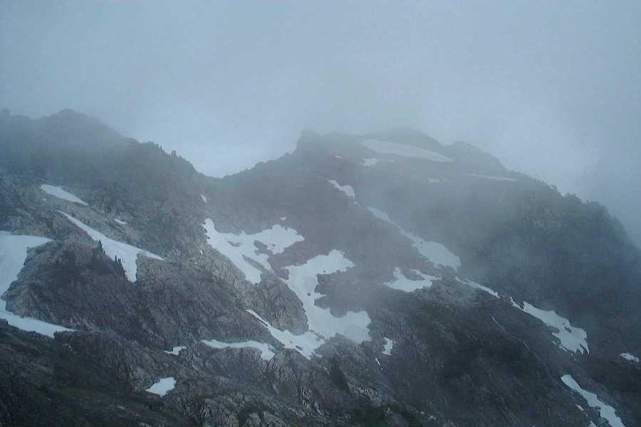
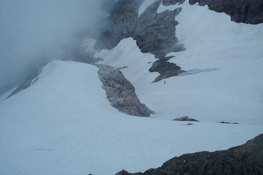
After the Marmots, it was time to get busy. This is where a good chunk of the elevation gain is done, right to the end of the trail at Tin Can (Pan?) Gap. You follow the narrow trail around and across all the snowfields you see below. These were kind of tricky. One slip, and your brains are scattered on the rocks at the end of the snowfield down below. On shaky knees & a drenched body, it was a very draining part of the trail. We passed through each snowfield shown on the left portion of the picture.
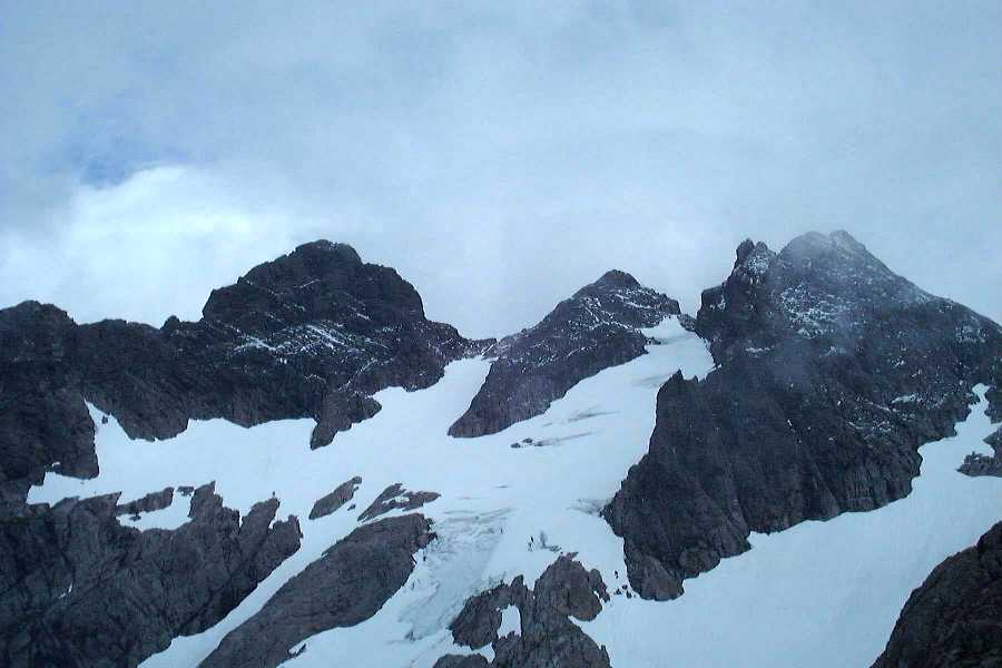
FINALLY, you get to the end of the trail after the snow fields, it wraps around the back of the slope seen above, and continues on to Tin Can (Pan?) Gap. But, we didn't make it that far due to fatigue and a massive snowfield that was potentially more dangerous than the ones we just crossed. So, we found a little spot and ate our lunch. The fog broke just in time to give us about 15 minutes of view, and then consumed the mountains again.
Queest-Alb glacier, directly below |
|
Three Fingers!!!! |
 |
So, we started down. The decent was long & painful. You know, up until that point, I don't think I have ever been happier to see my car!
Three Fingers/Goat Flats is a wonderful hike that needs to be done by anyone still looking to be impressed by mountains. My first experience was mixed. When it was good; it was excellent. But when it was bad, it was terrible. I plan to go back next year. Probably every year. What else could you ask for from a trail? Waterfalls, Marmots, meadows, scree slopes, alpine blueberries, glaciers, impressive snowy peaks and cliffs, what else do you need????
Ah, yes... Three Fingers. How many times do I have to say on this site on so many separate hiking excursions, that this is one of my favorite mountains? I hiked this last year in severe wetness and clouds, but it was still enough to be remembered as my favorite hike from last year. So, naturally, I had to go back this year. I had just hiked Gothic Basin the weekend prior, so I was prepared for the long hike to Tin Pan Gap, our final stop last year. Sure, I would love to go on past TPG and get closer to the 'how did they get that there' lookout at the top at 6800ft, but I'm just a goober, and the reports of the ladders attached to the sheer rock cliffs actually scared me away enough to try to convince myself that I really didn't need to go....
So, we started out the day a little too late, about 9:15 or so, but still plenty of time to get to the Gap, play around with Marmots, and hike back down. It was a nice cool day with no rain, but lots of high poofy clouds were moving in and out quite rapidly, which helped to keep it cool. When we got to Goat Flats, the clouds were quite prominent. Oh well. We pressed on


 |
The
next stop after Goat Flats is Marmot Scree. The marmots
were not out in full force like last year, but we did
find one on this rock here. The clouds were still in full force, and gave us this spectacular shot of the peaks at the top of the scree.
|
At about noon, if memory serves me correct, we made it up to Tin Pan Gap, where we stopped last time. It overlooks the Queest Alb Glacier right under the 3 fingers of Three Fingers. The clouds were behaving better than last year, but they were still coming in and out.

|
 |
We stopped there again, because the same snowfield that stopped us last year was still there, albeit much smaller than before. It looked kinda icky, and we contemplated trying to cross it. But, my cautious nature made me decide that where we were was good enough. But, Sunny had other ideas. She said, "I'm just going to put my crampons on and try it and see what is over there." Dammit. She made it across, and then disappeared around the corner.
 |
She
came back a minute later and waved me over. Shit. So, I
put my damn crampons on and negotiated the snowfield.
Then another snowfield. Then another one, (on the left) this one was practically a 70 degree grade down. But, we did it anyway. It took us awhile to get through this 1 mile course because we kept taking off and putting on our crampons. |
| The
trail winds around the right side of the finger, before
during back around and straight up the backside. This is
the side you see from the east, and from Squire Creek Pass. Before turning the corner, we got these shots.
|
 |
Now, this is where it gets interesting. The clouds were so thick that there was hardly a view. We got to the foot of this very large snowfield and we could not see where it went, how big it was, or even the footsteps very far up. We were tired, but stupid and determined to go on. It was large and steep, but it didn't appear to be any worse than other fields we have done, just bigger. So, we donned the crampons again, and started the very long trek up the field. Finally, FINALLY, we got to rock, and we were done with snow. We were at the foot of the Finger of the mountain that holds the Lookout. Now, we needed to scramble up some loose rocks for a bit, then the boot path re-appeared.
 |
Now,
the final moment. We had been going on nothing but a
determination to get to the lookout. We were tired, but
yet as we slowly walked the boot path and appreciated the
foggy yet great views, we noticed that we were at the
ladders. This was it. All that separated us from the
infamous lookout was about an 80 foot climb on 3 old
wooden ladders that were secured to the sheer rock walls
by rusting cables. Did I see that one of the cables was
broken? <ignore... ignore...> 3 ladders. One went straight up like a normal ladder from the ground, but then you had to grab onto another ladder at a different angle that was only attached to the rock. Then, the last ladder was a bit further away, and ascended up to the final TNT blasted away top of the mountain, and the glorious lookout! Oh MY! I made it! I conquered a mountain fear! Click on the picture to get a good view of one of the ladders and how it is attached. |
Once on top, we could look 360 degrees around, except for the lookout. Did you know you can sleep there??? Wow! One of the humbling things I experienced while up there was looking back down towards Squire Creek Pass, a trail I have done numerous times and looked UP at where I was now standing. You'll need to click on these pics to see them well.
 |
 |
 |
| This is Squire Creek Pass, it is about 3/5th of the way up the right side of the photo, and behind the clouds. The trail cuts across 2 boulder fields in the middle of the pic. If you look closely, you can find the straight line that crosses them. | Squire Creek Wall. This is the big wall you look up at while still in the beginning of the hike at Squire Creek Pass. | From Squire, you look up and down at this big basin that drops from Three Fingers and drains into Squire Creek. This is the perspective looking about 4500ft DOWN to the creek. If you look at the pic good, you can see the multiple cliffs that exist on the way down. Compare it to a shot from Squire. |
We had fun up at the top. But, we spent too much time up there, and it was now 5PM and we only had about 4 hours or so to descend the 8 miles down, including all the ladders, snowfields, and other obstacles we faced on the way up. Once we very carefully got off the ladders, we then had to go down that snowfield/icefield. This time, the clouds parted and let us see just how stupid we were. See the pink spec? That's me. See the lookout up top? That's where we went. Stupid, stupid, stupid.


We stopped at Tin Pan Gap for a minute to look back at Three Fingers and see where we went. You can see the lookout in the picture below.

After that, we had to haul ass back down. We were not making good time, as we were totally shot. But, the night does not wait for hikers to descend, it comes whether you like it or not. We thought we would make it, but we were wrong. We had to negotiate the final mile or so of a horrible trail in the dark. Even stupider, we did not have even have a flashlight, one of the 10 essentials. We did use the bright LCD from Sunny's camera for about the last half of it, and it help tremendously. But, it was tough. Sunny was understandably a bit freaked out by it; I was leading the way with the pupils in my eyes about the size of a quarter, trying to draw in any light possible. We finally made it to the trailhead in pitch black night at 10pm. Then we had to drive 18 miles down this stupid road in pitch black. We made it home fine, and went to work ON TIME the next day.
Looking back, I know it was stupid. We started too late, did not have enough food or water, not enough time, went farther than we are conditioned to go, and left without proper gear. BUT... what a hike. Next time? I'm camping at Goat Flat.
Go back to the main hiking page.


